Garmin
ECHOMAP Plus 42cv
ECHOMAP Plus 42cv
SKU:010-01884-00
Couldn't load pickup availability
A great addition to any fishing or boating trip
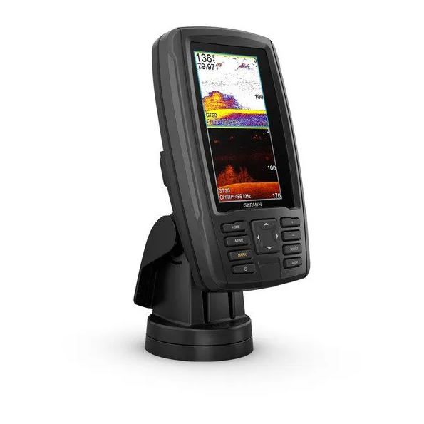
- Bright, sunlight-readable 4.3 inch combo
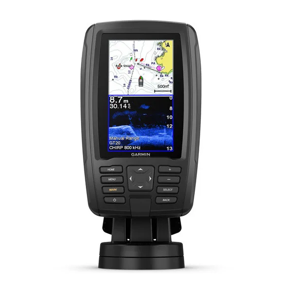
- Preloaded BlueChart® charts for the United Kingdom, Ireland and Northwest mainland Europe coast
- Built-in Garmin Quickdraw™ Contours mapping software instantly creates personalised fishing maps on-screen as you fish
- Share waypoints and routes with other ECHOMAP™ or STRIKER™ units
This compact combo has lots of built-in benefits. Easy-to-install and even easier to use, it has a bright 4.3” display that is easy to read on a sunny day on the water. It features built-in support for Garmin CHIRP traditional sonar that delivers remarkable target separation and CHIRP ClearVü™ scanning sonar for nearly photographic images of what’s below the boat. Preloaded with BlueChart charts for the U.K., Ireland and the Northwest mainland Europe coast. Plus, it has Quickdraw Contours mapping software to instantly create personalised fishing maps on-screen as you fish. You own these maps. They are yours to keep private or share with the Quickdraw Community on Garmin Connect™. Plus, you can share waypoints and routes with other ECHOMAP or STRIKER units. It also features a quick-release mount allowing you to quickly remove your device from power and mount.
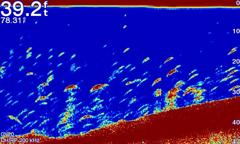
The Garmin CHIRP difference
The built-in sonar capabilities of ECHOMAP Plus 45cv include our CHIRP traditional sonar, one of the most sophisticated sonar technologies available for the fishing and boating public. CHIRP traditional sonar provides amazingly clear target separation and definition, because it puts even more energy onto the target than traditional sonar. It also provides traditional sonar support for Minn Kota® and MotorGuide® trolling motors with integrated transducers.
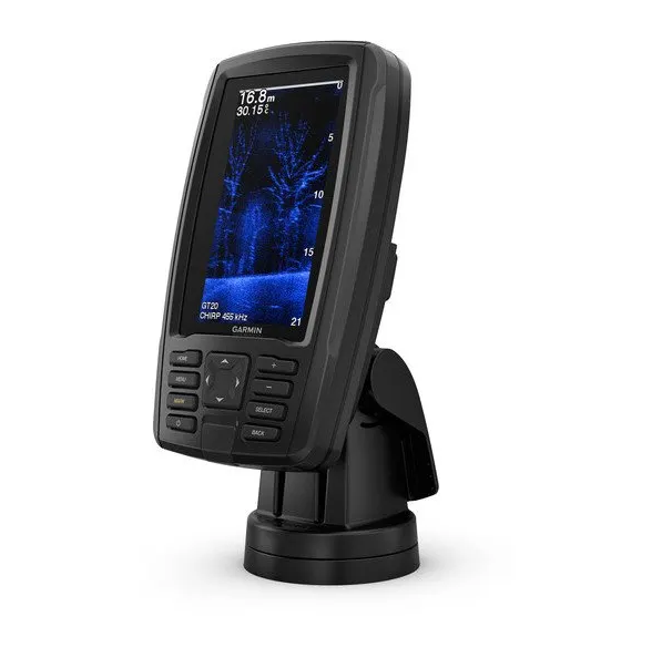
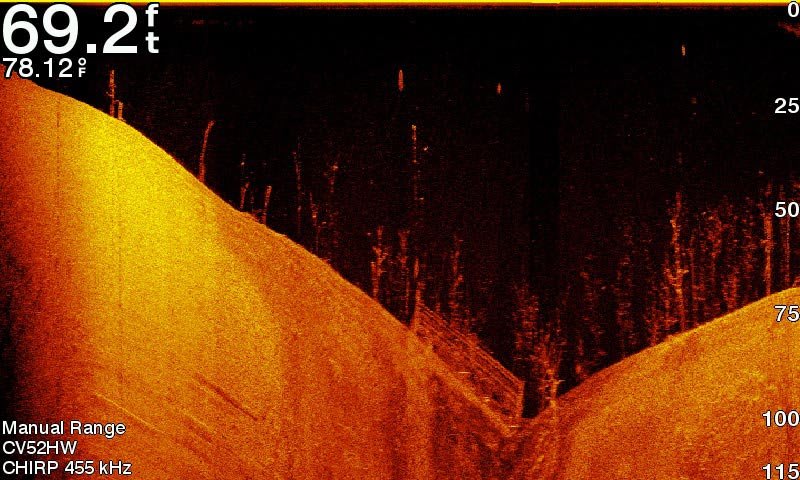
Clear scanning sonar images
Garmin CHIRP ClearVü scanning sonar gives you a nearly photographic image of what’s below your boat. You clearly see structure, submerged objects and fish.
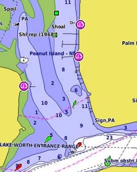
Preloaded BlueChart charts
Preloaded with highly detailed Garmin BlueChart mapping covering the British Isles in their entirety, including the Thames Estuary, Caledonian Canal, Outer Hebrides, Shetland and Orkney Islands, Isle of Wight, Isle of Man, Lough Neagh, The Shannon river (up to Lough Kee) and the Irish Sea. Continental coverage from Brest, FR to Kiel, DE including the Channel Islands, the Waddenzee, the IJsselmeer, the canals of The Netherlands, the Meuse River to Liege, BE; the Rhine River to Dusseldorf, DE and the Kiel Canal.
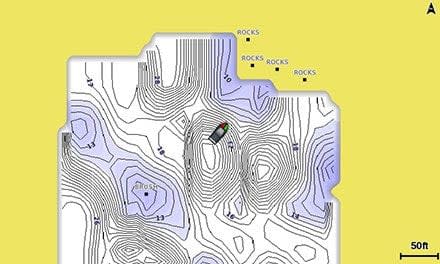
Quickdraw Contours to create your own maps
Instantly create personalised fishing maps on-screen, then tailor them to fit your needs. These are your maps — you own them. Keep the data to yourself, or share it with the Quickdraw Community on Garmin Connect™.
Take your ECHOMAP Plus with you
When you’re off the water, it’s easy to keep your ECHOMAP Plus combo safe and secure. You don’t have to mess with plugging and unplugging wires from the unit because the cords plug directly into the mount. This allows you to quickly install and remove your ECHOMAP Plus from power and the mount.
1 Auto Guidance is for planning purposes only and does not replace safe navigation operations. Pre-loaded BlueChart G3 charts for the UK and Ireland will not offer the Auto Guidance feature. To obtain this, an additional BlueChart G3 or G3 Vision chart is required.
Shipping & Returns
Shipping & Returns